Update date October 25, 2023, 1:14 a.m.
Otis was expected to make landfall Wednesday morning, bringing strong winds and heavy rain. The U.S. National Hurricane Center said it was already a Category 4 hurricane late Tuesday afternoon, with maximum sustained winds of 145 miles per hour (233 kilometers per hour).
Javier Berdin
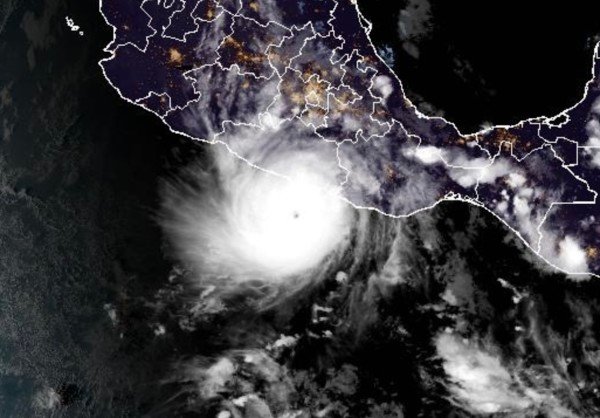
Acapulco, Mexico (Reuters) – Hurricane Otis was hurtling toward the popular beach resort of Acapulco on Tuesday, poised to make landfall on Mexico’s Pacific coast as an “extremely dangerous” Category 5 storm.
Otis was expected to make landfall Wednesday morning, bringing strong winds and heavy rain. The U.S. National Hurricane Center said it was already a Category 4 hurricane late Tuesday afternoon, with maximum sustained winds of 145 miles per hour (233 kilometers per hour).
Related item: How giant hurricanes rapidly intensify in just a few hours
The Miami-based NHC added that by 6pm local time (midnight Wednesday), Otis was approximately 135 miles south-southeast of Acapulco and would continue to strengthen before making landfall.
Once Otis makes landfall, it should weaken rapidly.
The coastline between Zihuatanejo, a beach town in Guerrero state where Acapulco is located, and Punta Maldonado is expected to reach hurricane status within 12 to 24 hours, the NHC said.
The storm could bring up to 15 inches (38 centimeters) of rain to parts of Guerrero and neighboring Oaxaca state, causing flash flooding, landslides, “life-threatening” storm surge, surf and rip current conditions. the center added.

